Meteorologists and climate experts have warned that climate change will intensify natural disasters such as tropical cyclones. However, Hurricane Otis displayed how rapidly such intensification may occur, stunning meteorologists and hindering evacuation warnings to residents and tourists.
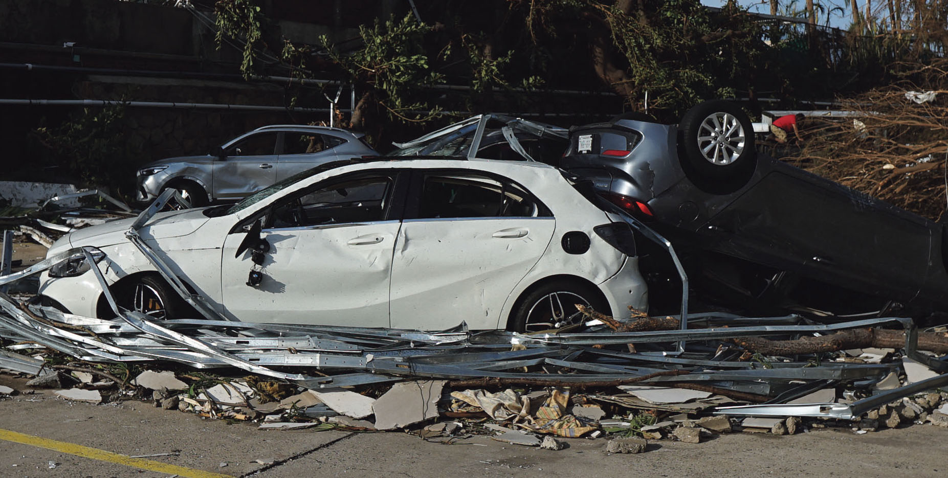
Otis began as a tropical storm in the Pacific Ocean and was expected to make landfall near Acapulco, Mexico. As residents went to sleep expecting heavy rains, they were soon bombarded by a Category 5 hurricane with 165 miles per hour winds. 48 people died, and the estimated damage was over $3 billion.
Meteorology has advanced significantly in recent decades, enabling reasonable accurate 10-day weather forecasts. Impending storms are actively tracked in real-time, and residents in the disaster path are usually given timely warnings of what to expect, including whether to evacuate. However, climate change is changing that. As ocean temperatures rise, they intensify tropical cyclones.
Meteorologist Judson Jones of The New York Times discussed on “The Daily” podcast how water at or above 80°F (27°C) fuels hurricanes. Climate change is causing the deeper upwelling water to remain above this temperature threshold, further fuelling storms. The surface temperature of the water where Otis was moving was 88°F (31°C).
“Rapid intensification” of a hurricane is considered an increase in wind speed of 35mph in 24 hours, but Otis intensified to 115mph in half that time. Because the storm occurred at night, when residents and many meteorologists in the time zone were asleep, the region woke up to the stunning devastation. The US National Hurricane Centre described Otis as having “explosively intensified.”
The El Niño Southern Oscillation is a climate phenomenon denoting warmer ocean temperatures in the eastern Pacific that is currently in force and plays a role in the storm’s intensity.
According to NOAA’s National Environmental Satellite, Data, and Information Service, only one other hurricane on record has intensified more quickly than Otis. Hurricane Patricia also hit Mexico during an El Niño year in 2015 and increased by 120 mph in 24 hours. However, Patricia resulted in fewer casualties than Otis.
Meteorologists have access to state-of-the-art forecasting equipment, allowing for better data upon which to predict a storm’s intensity and trajectory, but climate change is outpacing the technology’s ability to forecast effectively in a crisis. Jones stated, “It’s almost like we turned back the clock a little bit on forecasting.” Less accurate forecasts may result in greater loss of life during natural disasters.
According to Columbia News, “all of the commonly used hurricane models failed to predict Otis’ rapid intensification into a major hurricane.”
Innovative technologies are emerging to track hurricanes and offer better predictions. Sail drones are wind-propelled vehicles sent out into the ocean to track hurricanes in real-time. A sail drone is equipped with cameras, a barometer, solar panels, and sensors to measure ocean and air temperature, as well as wave height and salinity. The information will be used to understand why hurricanes intensify, but we will need to gather data for several years to understand useful markers.
Meteorological forecasts are dependable for day-to-day temperature and precipitation monitoring and have saved lives by warning residents of impending disasters. However, past predictions have been wrong, as tropical cyclones do not always follow the anticipated path.
Last year, Hurricane Ian devastated Florida. Residents in St. Petersburg, farther north of where Ian made landfall, were ordered to evacuate early, while those in Ft. Myers were left scrambling when the hurricane hit there instead.
Climate scientists have offered apt theories about how climate change will exacerbate the severity of natural disasters, but in a sense, what they have predicted is a level of unpredictability. There is an understanding of greater magnitudes of devastation and loss of life, but to the point that some of the modern technology that leaders rely on to keep people out of harm’s way is becoming inadequate.
Technological advancements are making strides, as are emission reduction measures. However, the world is not on track to meet the Paris Climate
Agreement goals. It has been widely accepted that the threshold of keeping temperatures below 1.5°C above preindustrial levels will be breached. If disasters like Otis occur when temperatures have not yet reached that level and 2°C is the new goal, how many future Category 5 hurricanes are meteorologists unlikely to predict.
Photo: A view of a street after Hurricane Otis in Guerrero, Mexico, on October 26.
(Credit: Silvana Flores/Anadolu Agency)
Sarah Sakeena Marshall,
American University’s School of Intl Service, The Muslim News Environmental Columnist